


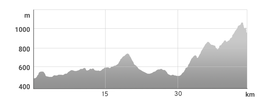
![]() BIKE-A-THON (BAT) - Endurance 46 km ride with elevation gain of 1243 m with one timed section. The riders choose their own tempo which will allow them to finish the course in the given time limit (based on the minimum average speed 10 km/h including all stops on the course)
BIKE-A-THON (BAT) - Endurance 46 km ride with elevation gain of 1243 m with one timed section. The riders choose their own tempo which will allow them to finish the course in the given time limit (based on the minimum average speed 10 km/h including all stops on the course)
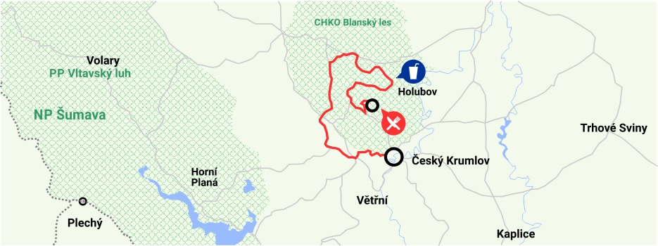
Start (13:00) - Český Krumlov (Parking P3),Důlní ulice, Zámecká jízdárna,Vodotrysk, Kájov, Boletice, Chvalšiny, Rohy, Rojšín, Lhotka, Loučej, Chlum, Holubov (W), Krásetín, Hejdlov, Plánský, the summit of Klet (RP) - Finish
Annotation: italics – timed sections (TS), RP – refreshment place with WC, W - water
| 46 km | 1243 m | 1 | 13:00 |
| DISTANCE | ELEVATION GAIN | Timed sections | START |
| TS | Name of the TS | Distance | Climb | Start of the TS from Start |
| 1 | Hejdlov - Plánský | 1.7 km | 96 m | 41 km |